How GIS Supports Better Infrastructure Planning in Kenyan Towns.
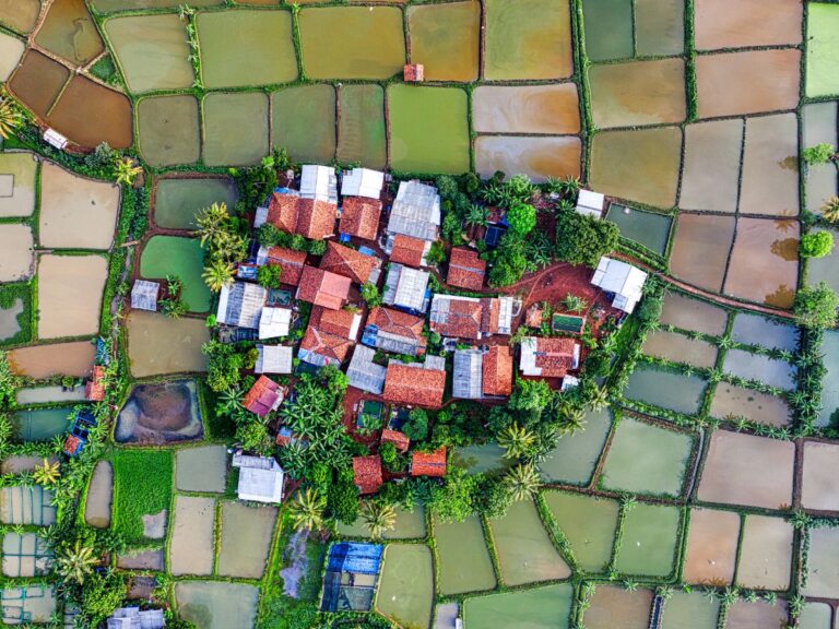
Kenyan towns are rapidly evolving—from Nairobi’s expanding suburbs to emerging urban centers like Kisumu, Nakuru, and Eldoret. As populations grow, the demand for smarter, more efficient infrastructure has become urgent. The most effective tool guiding these developments is Geographic Information Systems (GIS).
GIS supports better infrastructure planning in Kenyan towns by providing accurate data for decision-making, enabling efficient land use, improving utility service delivery, and supporting climate-resilient urban growth. It allows planners, local governments, and engineers to visualize spatial relationships, model future scenarios, and optimize infrastructure investments.
Here’s how GIS technology is transforming infrastructure planning across Kenya’s urban landscapes.
1. Smart Land Use and Urban Growth Management
Urban expansion in Kenya is often unplanned, especially in informal settlements. GIS provides the spatial insight necessary to design smarter, more structured towns.
GIS helps cities like Nairobi and Mombasa balance population growth with sustainable land development.
Mapping Land Use Patterns
With GIS, planners can:
- Analyze current land use across residential, commercial, industrial, and agricultural zones.
- Overlay zoning laws to ensure compliance or highlight violations.
- Identify underutilized or vacant plots that could be redeveloped.
This spatial clarity allows towns to allocate land more efficiently and avoid common problems like congestion, haphazard settlements, and environmental degradation.
Modeling Urban Expansion
GIS software can simulate urban growth patterns based on population trends, economic activity, and road networks. Planners use these projections to:
- Forecast housing needs
- Plan transportation routes
- Ensure public spaces and utilities are included
In fast-growing areas like Thika and Kitengela, these simulations help avoid the pitfalls of unregulated sprawl.
2. Supporting Water, Sewer, and Electricity Infrastructure
Providing clean water, sanitation, and electricity in Kenyan towns is a major infrastructure challenge—especially in growing peri-urban areas. GIS is central to designing and managing these systems.
By using GIS to map utility lines, engineers can ensure consistent coverage and prevent service gaps or redundancies.
Water and Sewer Network Planning
GIS tools help water authorities:
- Map existing pipes, reservoirs, and treatment plants
- Identify areas underserved by clean water
- Simulate demand increases due to new housing
With this data, utilities can phase expansion projects cost-effectively, reducing waste and improving access.
Electric Grid Optimization
Kenya Power and other energy stakeholders rely on GIS to:
- Locate transformers and substations
- Plan grid extensions into rural or low-income urban areas
- Monitor outages and predict high-demand zones
In towns like Naivasha and Kakamega, this allows for better service coverage and reduced blackouts.
3. Transportation Network Design and Traffic Management
Infrastructural bottlenecks, especially on roads, are a major concern for growing towns. GIS offers a solution by integrating traffic data, commuter patterns, and road conditions to design smarter transit networks.
Using GIS, planners can identify the most efficient routes, reduce travel times, and enhance road safety.
GIS Applications in Road Planning
Municipal governments and the Kenya Urban Roads Authority (KURA) use GIS to:
- Analyze vehicle counts and traffic flow using real-time GPS data
- Map accident hotspots to target safety improvements
- Design new roads with minimal disruption to existing land uses
This is especially useful in towns like Eldoret or Kisumu where rapid development risks outpacing transport planning.
Public Transport Optimization
GIS is also helping modernize public transit by:
- Mapping matatu (minibus) routes and stages
- Identifying underserved neighborhoods
- Planning integrated systems including rail and bus rapid transit (BRT)
This contributes to reduced congestion, air pollution, and commuting costs.
4. Enhancing Disaster Risk Management and Resilience
Kenyan towns face climate-related risks including floods, landslides, and drought. GIS enables local governments to prepare and respond with greater precision.
By layering environmental data, GIS reveals vulnerable areas and informs infrastructure decisions that increase town resilience.
Flood Risk Mapping
Counties like Kisumu and Garissa use GIS to:
- Identify flood plains based on elevation and rainfall data
- Map stormwater drainage capacity
- Target flood-prone settlements for relocation or upgrading
GIS maps help allocate resources like emergency shelters or drainage upgrades more effectively.
Environmental Impact Assessments
Before infrastructure is built, GIS supports Environmental Impact Assessments (EIA) by:
- Identifying proximity to wetlands, forests, or protected areas
- Assessing the impact of construction on wildlife corridors
- Monitoring pollution levels over time
This ensures that development projects comply with national regulations and reduce harm to natural systems.
5. Transparent Planning and Public Participation
A core challenge in Kenyan urban development is transparency and community inclusion. GIS promotes both by making planning data visual, interactive, and accessible to stakeholders.
When local citizens and decision-makers can see spatial data, they’re more likely to engage meaningfully in the planning process.
Interactive Mapping for Stakeholder Engagement
Counties like Machakos and Laikipia are adopting digital dashboards that:
- Allow residents to explore proposed zoning changes
- Show timelines for infrastructure upgrades
- Collect feedback on urban projects through online platforms
This leads to better buy-in, fewer disputes, and more accountable use of public funds.
Integrating Census and Socioeconomic Data
By overlaying census statistics with geospatial maps, towns can:
- Target infrastructure where population density is highest
- Prioritize underserved communities
- Evaluate the impact of past projects on poverty or access
GIS bridges the gap between policy and data, enabling results-driven planning.
Comparison Table: GIS vs Traditional Planning Methods
| Feature/Function | Traditional Planning | GIS-Enabled Planning |
|---|---|---|
| Data Visualization | Mostly paper maps or static PDFs | Interactive, layered digital maps |
| Land Use Analysis | Manual surveys | Satellite imagery and spatial data |
| Utility Mapping | Paper-based, often outdated | Real-time digital asset tracking |
| Environmental Impact Assessment | Separate reports | Integrated maps + risk models |
| Public Engagement | Town hall meetings | Online dashboards, map viewers |
| Disaster Risk Modeling | Basic elevation maps | Flood simulations, heat maps |
| Infrastructure Cost Estimation | Spreadsheet-based | Spatial cost modeling |
| Monitoring & Evaluation | Annual reports | Live dashboards, GIS-based audits |
GIS allows planners to analyze more data faster and collaborate better with both agencies and communities.
Real-World Examples of GIS in Kenyan Town Planning
Several counties are already embracing GIS with impressive results:
1. Nairobi County: Smart Infrastructure Mapping
Nairobi City County has developed a GIS master plan to integrate land records, building permits, roads, and water systems in one digital environment. This enables quicker approvals, better zoning enforcement, and coordinated infrastructure delivery.
2. Nakuru: Using GIS to Improve Waste Management
GIS tools helped Nakuru County identify underserved neighborhoods and optimize garbage collection routes, cutting costs and improving cleanliness in informal settlements.
3. Kisumu: GIS-Based Drainage Planning
Kisumu’s frequent flooding led to a partnership with the World Bank to use GIS for stormwater modeling. The city now prioritizes drainage upgrades based on flood risk zones, not political pressure.
6. Challenges Facing GIS Implementation in Kenyan Towns
While GIS offers many benefits, there are still barriers to widespread adoption.
Lack of skilled personnel, budget constraints, and inconsistent data standards are major hurdles for Kenyan counties.
Limited GIS Capacity
Many towns lack in-house GIS experts or access to ongoing training. Even when systems are purchased, they often sit underutilized due to limited staff capacity.
Cost of Software and Data
Although open-source platforms exist, many counties rely on expensive proprietary software. Acquiring up-to-date satellite imagery or conducting detailed surveys is also costly.
Data Integration and Inter-agency Sharing
Infrastructure planning involves many departments—land, roads, housing, utilities. Without a shared platform or data governance policy, siloed systems make collaboration difficult.
Best Practices to Expand GIS Use in Kenyan Towns
Despite challenges, the following practices can accelerate GIS adoption:
- Invest in training: Partner with universities like JKUAT or TUK to build local GIS talent.
- Use open-source GIS platforms: Tools like QGIS are free and highly capable.
- Digitize existing records: Scanning and geotagging paper maps and land files creates a usable foundation.
- Develop central GIS units: County governments should create dedicated GIS teams to coordinate data.
- Promote inter-agency collaboration: Infrastructure departments should share data on a common platform to streamline planning.
With the right strategy, even small towns can unlock the benefits of GIS without massive budgets.
GIS for Infrastructure Resilience in Kenyan Towns
As Kenya continues urbanizing, GIS will be a cornerstone of resilient infrastructure planning. Whether designing road systems in Eldoret or mapping drainage in Kisumu, the ability to combine data, maps, and models will define the next generation of urban growth.
GIS empowers counties to move from reactive fixes to proactive solutions—improving service delivery, reducing risks, and ensuring inclusive development for all urban residents.
Looking ahead, integrating GIS with drones, mobile data collection, and citizen feedback apps could revolutionize how towns plan and manage infrastructure. The journey to smarter cities in Kenya starts with a map—and the insights to act on it.