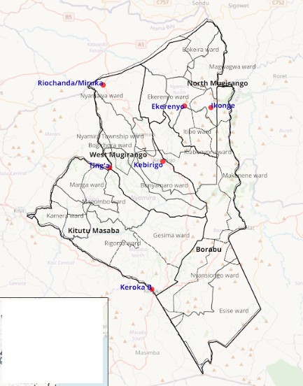
I completed my Bachelor of Arts in Urban and Regional Planning with IT at Maseno University, where I developed a strong grounding in spatial thinking, land use planning, and urban systems. During this period, my interest in GIS grew as I explored how maps and spatial data could support better planning and development decisions.
GIS Analyst & Spatial Planning Specialist
BRUCE KITIVO MAKAU
GIS Analyst and Spatial Planner with hands-on experience in spatial analysis, cartography, geospatial data management, and field-based data collection. Skilled in producing high-quality maps and analytical outputs to support urban planning, infrastructure, and development initiatives.
What I Do
My work focuses on applying GIS as an analytical and decision-support tool within urban and regional planning contexts. I use spatial data to explore patterns, relationships, and constraints that shape development and service provision.
Bruce is a skilled GIS professional who effectively turns ideas into clear and meaningful spatial outputs. He collaborates easily with multidisciplinary teams, combining technical expertise and creativity to add value to projects.
Timeline
Following my studies, I transitioned into applied research and data work, supporting structured surveys, data cleaning, and analysis. This period strengthened my analytical skills and introduced me to working with real datasets, research teams, and evidence-based reporting.
I began working more directly with GIS tools, producing maps, managing spatial datasets, and supporting field-based data collection. I gained experience in settlement mapping, land use analysis, environmental layers, and spatial data quality control, linking field realities with geospatial outputs.
I supported GIS-based research and planning projects across multiple counties, contributing to spatial analysis, accessibility studies, and urban–rural linkages. This work strengthened my ability to translate spatial data into clear visuals and insights for technical reports and planning processes.